| |
Canku Ota
|
|
|
(Many Paths)
|
||
|
An Online Newsletter
Celebrating Native America
|
||
|
August 1, 2011 - Volume
9 Number 8
|
||
|
|
||
|
Canoe Families
Play Starring Role in Study of Salish Sea Conditions
|
||
|
by Kara Briggs and Brent
Merrill Coast Salish Gathering News
|
||
|
credits: photo by Corey
Conteros
|
|
Partnering with the U.S. Geological Survey, the canoes were outfitted with measuring equipment small enough to be held in one hand and strong enough to be towed hundreds of miles behind the canoes. The tools, called YSI multiparameter water quality sondes, send signals to Google Maps with near real-time information about water conditions. Canoe families who participated in the study during the Canoe Journey were from the Squaxin Island Tribe, Swinomish Indian Tribal Community and Sauk-Suiattle Tribe from Western Washington and the Squamish First Nation and Musgamagw Tribe of British Columbia. The 2011 summer's cool start was reflected in initial results from South Salish Sea, where temperatures of surface waters averaged 12.3º C (54.1º F). In 2009, temperatures of surface water averaged 18.6º C (65.5º F). In 2008 and 2010, the average water temperature in the same area was 14.4º C (58º F).
Samples taken by motorized boats can be tainted by exhaust, fuel remnants and propeller turbulence. While traveling their ancestral highway, canoe families simultaneously measure many conditions, including surface-water temperature, conductivity, salinity, pH, dissolved oxygen and turbidity, producing multiple water-property profiles every 10 seconds across the Salish Sea. Scientists travel in canoes with pullers and skippers, so they can work together to collect observational data. In these interactions, indigenous knowledge is integrated with modern science to improve everyone's understanding of the Salish Sea's natural history. The perspectives are ones that science alone cannot offer. The exchanges made between scientists and Coast Salish culture bearers, with their traditional knowledge from their communities, increases the overall understanding of conservation and stewardship in the Salish Sea. Among canoe families, even those not participating in this year's study, water conditions are a continuous topic of conversation. At Seattle's Alki Beach on Wednesday, July 20, puller Todd Wescott of the Puyallup Tribe was among those who observed a lot of red algae on the six-hour pull from the Port of Tacoma. "The USGS appreciates the wonderful partnership with Coast Salish and encourages everyone to visit the Tribal Journey landings and website to follow our progress," said scientist Eric Grossman of the U.S. Geological Survey. Results are posted in near real-time on Google Maps. Four years of results map patterns of ocean mixing and river runoff, which strongly affect habitats and ecosystems where the Coast Salish peoples have lived for millennia. Deteriorating water quality from land use (runoff of toxics, excess sediments, nutrients) and change in ocean conditions (warming, ocean acidification) threaten Salish Sea fish and shellfish, and the habitats that support them. "There are few comprehensive studies of nearshore ecosystems along the thousands of miles of Salish Sea shoreline that the Tribal Journey travels, and its salmon, forage fish, crab, clams and oysters rely upon," said Grossman. This is only one of many studies that are needed to expand the understanding of how land use and climate change are affecting the amazing Salish Sea ecosystem, he said. Participants in the Coast Salish-U.S. Geological Survey (USGS) Tribal Journey Water Quality Project were recognized recently with the U.S. Department of the Interior (DOI) Partners in Conservation Award. The award recognizes the strength of collaborative activities, such as the USGS partnership with the Coast Salish Western Washington Tribes and British Columbia First Nations. "The Salish Sea Ecosystem sustains our indigenous life way as People of the Salmon and Shoreline," said Chairman of the Swinomish Tribe Brian Cladoosby. "We say in our Lands, 'When the Tide is out, the Table is set.' Our way of life depends upon a healthy ecosystem that stretches from the mountains to the tidelands. Through the partnerships and project, we have a stronger science and policy capacity to protect the human health of our people, our culture, and aboriginal and treaty rights of our Nations." This study is one of the things that can make the Paddle to Swinomish even more relevant to all the people who live in the Salish Sea watershed. "As we are paddling, we are renewing our cultures and connections," Frank said. "We are also contributing important information to the fight to clean up Puget Sound and protect our coastal waters." View the Salish Sea Tribal Journey Water Quality Study on Google Maps at www.usgs.gov/coastsalish
|
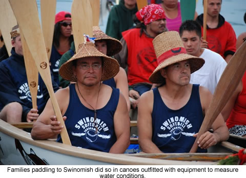 Canoe
families from Western Washington and British Columbia participated
in the fourth year of a unique study of water quality in the Salish
Sea during their paddle to Swinomish.
Canoe
families from Western Washington and British Columbia participated
in the fourth year of a unique study of water quality in the Salish
Sea during their paddle to Swinomish. 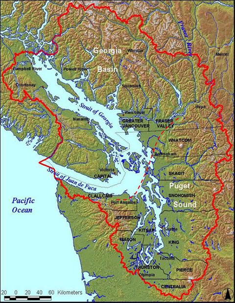 "Our
canoes work best for this project because they don't use motors,
they can cover a large area and they don't churn up the water,"
said Northwest Indian Fish Commission Chairman Billy Frank Jr. "This
is just the right kind of vehicle to gather this kind of information."
"Our
canoes work best for this project because they don't use motors,
they can cover a large area and they don't churn up the water,"
said Northwest Indian Fish Commission Chairman Billy Frank Jr. "This
is just the right kind of vehicle to gather this kind of information."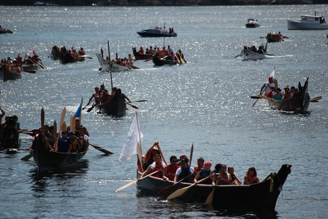
|
|
||
|
|
||
|
|
||
|
|
||
| Canku Ota is a free Newsletter celebrating Native America, its traditions and accomplishments . We do not provide subscriber or visitor names to anyone. Some articles presented in Canku Ota may contain copyright material. We have received appropriate permissions for republishing any articles. Material appearing here is distributed without profit or monetary gain to those who have expressed an interest. This is in accordance with Title 17 U.S.C. Section 107. | ||
|
Canku Ota is a copyright ©
2000, 2001, 2002, 2003, 2004, 2005, 2006, 2007, 2008, 2009, 2010,
2011 of Vicki Barry and Paul Barry.
|
||
| |
|
|
|
The "Canku
Ota - A Newsletter Celebrating Native America" web site and
its design is the
|
||
|
Copyright ©
1999, 2000, 2001, 2002, 2003, 2004, 2005,
2006, 2007, 2008, 2009, 2010, 2011
of Paul C. Barry.
|
||
|
All Rights Reserved.
|
||